TfNSW - Level of Service
Researcher(s): Prof. S. Travis Waller, Dr. Kasun Wijayaratna, Dr Sisi Jian, Dr Divya Nair
The future of Level of Service – Accounting for Movement and Place: Development of the NSW Road Planning Framework
Level of Service (LoS) is a traffic engineering grading system used to assess the performance of transport infrastructure, such as road corridors and intersections. The LoS methodology offers practitioners a tool to identify failing infrastructure and accordingly develop remediating actions to improve the service provided to a customer.
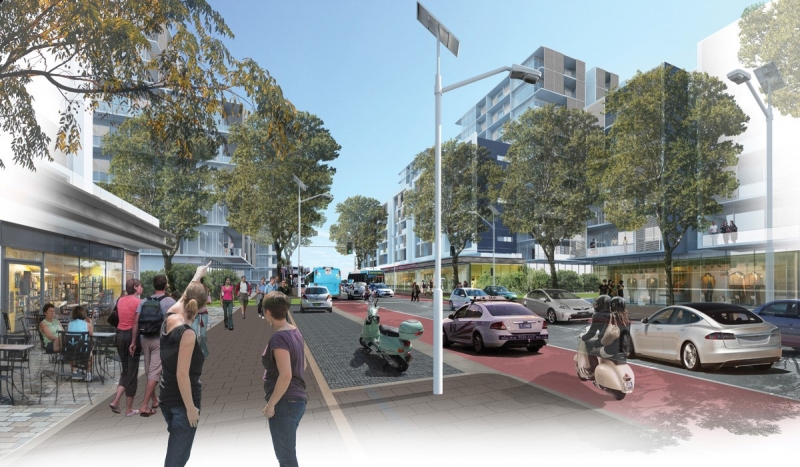
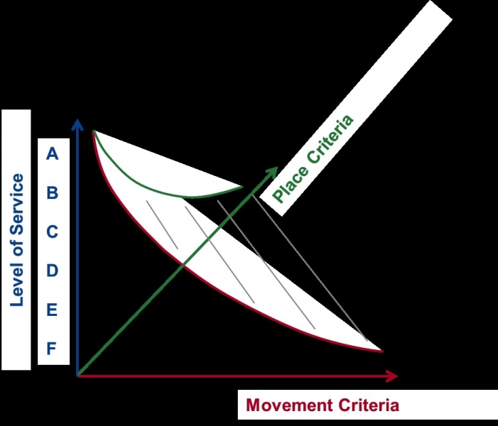
LoS assessments of roads have generally focused on the movement of vehicles. However, roads serve not only for the purposes of ‘movement’ of private vehicles but also as a ‘place’ which supports activities conducted on adjacent land uses. Depending on the context, the community desires road segments that are free of congestion for vehicles, are safe to walk and cycle on and provide accessibility to commercial and employment opportunities. Transport for New South Wales (TfNSW) are at the forefront of capturing the duality of road corridors through the newly formed ‘Movement and Place’ (M&P) concept which has developed LoS metrics that focus on place as well as movement along a road corridor.
RCITI is collaborating with TfNSW to benchmark the M&P concept to enhance the NSW Road Planning Framework. This research has developed an aggregation methodology to define singular holistic LoS metrics that account for multiple modes of transport as well as the movement functionality and the place environment of a road corridor.
 |
 |